![]()
![]()
荒川 ![]()
2017/07/02 10:11 - 12:59 / Not set
![]()
| Total distance: | 62.28 | km | Trip time: | 2:48'07 | Average speed: | 28.3 | km/h | |
|---|---|---|---|---|---|---|---|---|
| Ascending altitude: | 608 | m | Elapsed time: | 2:12'12 | Total calories: | 1636 | kcal |
荒川
- Not set・ 2017/07/02 10:11 - 12:59
-
[Trip time] 2:48'07
[Total distance] 62.28km
[Average speed] 28.3km/h [Ascending altitude] 608m [Total calories] 1636kcal
[Tags]


-
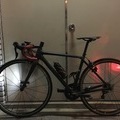
- Addict30
- View other bikes
skyuyoukai
(
Male /
Japan )
0
0

 ざっきー
ざっきーGPX export
Are you sure you want to export GPX data for this trip?
![]()
![]()