![]()
![]()
Quick route ![]()
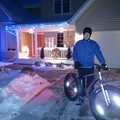
2017/08/25 13:59 - 15:06 / USA Cambridge , Minnesota
![]()
| Total distance: | 27.63 | km | Trip time: | 1:06'54 | Average speed: | 26 | km/h | |
|---|---|---|---|---|---|---|---|---|
| Ascending altitude: | 141 | m | Elapsed time: | 1:02'26 | Total calories: | 545 | kcal |
| Split time | 00:01’08 | |
|---|---|---|
| Lap time | 00:01’08 | |
| Trip lap distance | 10.11 | km |
| Average | Maximum | |||
|---|---|---|---|---|
| Lap speed | 10.3 | km/h | 25 | km/h |
| Lap heart rate | 138.5 | bpm | 163 | bpm |
| Lap cadence | 50.1 | rpm | 87.5 | rpm |
Quick route
- USA・Cambridge , Minnesota 2017/08/25 13:59 - 15:06
-
[Trip time] 1:06'54
[Total distance] 27.63km
[Average speed] 26km/h [Ascending altitude] 141m [Total calories] 545kcal
[Tags] Road bike


-
- TREK
- View other bikes
0
0

 Bob
BobGPX export
Are you sure you want to export GPX data for this trip?
![]()
![]()