![]()
![]()
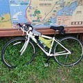
有明公園〜古川〜古三津 ![]()
2017/11/13 10:06 - 12:44 / Not set
![]()
| Total distance: | 33.34 | km | Trip time: | 2:37'22 | Average speed: | 15.3 | km/h | |
|---|---|---|---|---|---|---|---|---|
| Ascending altitude: | 316 | m | Elapsed time: | 2:12'06 | Total calories: | 341 | kcal |
有明公園〜古川〜古三津
- Not set・ 2017/11/13 10:06 - 12:44
-
[Trip time] 2:37'22
[Total distance] 33.34km
[Average speed] 15.3km/h [Ascending altitude] 316m [Total calories] 341kcal
[Tags]


-
- アンカー
- View other bikes
taka
(
Male /
Japan )
0
0

 tacobose
GPX export
Are you sure you want to export GPX data for this trip?
![]()
![]()