![]()
![]()
サンパーク井門〜市駅〜衣山〜春美 ![]()
2018/03/25 08:57 - 11:02 / Japan 松山市
![]()
| Total distance: | 30.97 | km | Trip time: | 2:04'33 | Average speed: | 17.1 | km/h | |
|---|---|---|---|---|---|---|---|---|
| Ascending altitude: | 329 | m | Elapsed time: | 1:49'16 | Total calories: | 352 | kcal |
サンパーク井門〜市駅〜衣山〜春美
- Japan・松山市 2018/03/25 08:57 - 11:02
-
[Trip time] 2:04'33
[Total distance] 30.97km
[Average speed] 17.1km/h [Ascending altitude] 329m [Total calories] 352kcal
[Tags] Bicycle, Road bike


-
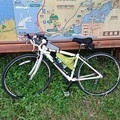
- アンカー
- View other bikes
taka
(
Male /
Japan )
0
0

 tacobose
GPX export
Are you sure you want to export GPX data for this trip?
![]()
![]()