![]()
![]()
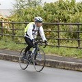
昭和中央〜大楽毛〜湿原道路〜運動公園〜幣舞橋 ![]()
2018/05/05 09:24 - 12:23 / Not set
![]()
| Total distance: | 51.04 | km | Trip time: | 2:59'20 | Average speed: | 24.2 | km/h | |
|---|---|---|---|---|---|---|---|---|
| Ascending altitude: | 236 | m | Elapsed time: | 2:08'21 | Total calories: | 890 | kcal |
昭和中央〜大楽毛〜湿原道路〜運動公園〜幣舞橋
- Not set・ 2018/05/05 09:24 - 12:23
-
[Trip time] 2:59'20
[Total distance] 51.04km
[Average speed] 24.2km/h [Ascending altitude] 236m [Total calories] 890kcal
[Tags]


-
- FELT
- View other bikes
遠藤 匡
(
Male )
0
0

 masa
masaGPX export
Are you sure you want to export GPX data for this trip?
![]()
![]()