![]()
![]()
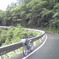
高槻~妙見山~一庫ダム~能勢町役場 ![]()
2018/05/20 08:18 - 13:48 / Japan 高槻~妙見山~一庫ダム~能勢町役場
![]()
| Total distance: | 111.31 | km | Trip time: | 5:30'10 | Average speed: | 22.9 | km/h | |
|---|---|---|---|---|---|---|---|---|
| Ascending altitude: | 2403 | m | Elapsed time: | 4:49'43 | Total calories: | 972 | kcal |
| Split time | 00:01’08 | |
|---|---|---|
| Lap time | 00:01’08 | |
| Trip lap distance | 10.11 | km |
| Average | Maximum | |||
|---|---|---|---|---|
| Lap speed | 10.3 | km/h | 25 | km/h |
| Lap heart rate | 138.5 | bpm | 163 | bpm |
| Lap cadence | 50.1 | rpm | 87.5 | rpm |
高槻~妙見山~一庫ダム~能勢町役場
- Japan・高槻~妙見山~一庫ダム~能勢町役場 2018/05/20 08:18 - 13:48
-
[Trip time] 5:30'10
[Total distance] 111.31km
[Average speed] 22.9km/h [Ascending altitude] 2403m [Total calories] 972kcal
[Tags] Road bike, Training, Mountain


-
- トレック
- View other bikes
kego
(
Male /
Japan )
0
0

 ありぴ
ありぴGPX export
Are you sure you want to export GPX data for this trip?
![]()
![]()