![]()
![]()
大串半島道路崩壊して通行不可 ![]()
2018/07/08 15:17 - 16:42 / Japan 香川県さぬき市
![]()
| Total distance: | 19.22 | km | Trip time: | 1:25'27 | Average speed: | 16.3 | km/h | |
|---|---|---|---|---|---|---|---|---|
| Ascending altitude: | 408 | m | Elapsed time: | 1:10'45 | Total calories: | 244 | kcal |
大串半島道路崩壊して通行不可
- Japan・香川県さぬき市 2018/07/08 15:17 - 16:42
-
[Trip time] 1:25'27
[Total distance] 19.22km
[Average speed] 16.3km/h [Ascending altitude] 408m [Total calories] 244kcal
[Tags]
オートキャンプ場のすぐ南の車道が10m程度崩落し、下のサイクリングロードも塞がっています。7月8日正午頃に発生したそうです。


-
- CYCLONE
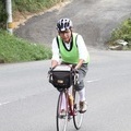
愛車とはもう40年の付き合いです。
View other bikes
まなぶ
(
Male /
Japan )
四国一周にチャレンジしています。
0
0

 tacobose
GPX export
Are you sure you want to export GPX data for this trip?
![]()
![]()