![]()
![]()
石手川ダム~吉藤~新浜 ![]()
2018/08/10 18:03 - 20:27 / Japan 松山市
![]()
| Total distance: | 35.33 | km | Trip time: | 2:23'53 | Average speed: | 16.7 | km/h | |
|---|---|---|---|---|---|---|---|---|
| Ascending altitude: | 613 | m | Elapsed time: | 2:09'13 | Total calories: | 481 | kcal |
石手川ダム~吉藤~新浜
- Japan・松山市 2018/08/10 18:03 - 20:27
-
[Trip time] 2:23'53
[Total distance] 35.33km
[Average speed] 16.7km/h [Ascending altitude] 613m [Total calories] 481kcal
[Tags] Bicycle, Road bike


-
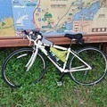
- アンカー
- View other bikes
taka
(
Male /
Japan )
0
0

 seki
sekiGPX export
Are you sure you want to export GPX data for this trip?
![]()
![]()