![]()
![]()
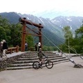
夕立神パノラマ公園~鳥倉林道~登山口往復 ![]()
2018/10/28 06:59 - 08:27 / Japan 大鹿村 鳥倉林道
![]()
| Total distance: | 13.84 | km | Trip time: | 1:28'11 | Average speed: | 12.7 | km/h | |
|---|---|---|---|---|---|---|---|---|
| Ascending altitude: | 425 | m | Elapsed time: | 1:05'44 | Total calories: | 383 | kcal |
夕立神パノラマ公園~鳥倉林道~登山口往復
- Japan・大鹿村 鳥倉林道 2018/10/28 06:59 - 08:27
-
[Trip time] 1:28'11
[Total distance] 13.84km
[Average speed] 12.7km/h [Ascending altitude] 425m [Total calories] 383kcal
[Tags] MTB, Recreation, Mountain


-
- camber comp
- View other bikes
山屋
(
Male /
Japan )
0
0

 山屋
山屋GPX export
Are you sure you want to export GPX data for this trip?
![]()
![]()