![]()
![]()
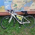
大山寺~白石の鼻~高浜 ![]()
2019/08/12 11:21 - 11:55 / Japan 松山市
![]()
| Total distance: | 11.35 | km | Trip time: | 163:47'52 | Average speed: | 18.4 | km/h | |
|---|---|---|---|---|---|---|---|---|
| Ascending altitude: | 141 | m | Elapsed time: | 0:36'45 | Total calories: | 30 | kcal |
| Split time | 00:01’08 | |
|---|---|---|
| Lap time | 00:01’08 | |
| Trip lap distance | 10.11 | km |
| Average | Maximum | |||
|---|---|---|---|---|
| Lap speed | 10.3 | km/h | 25 | km/h |
| Lap heart rate | 138.5 | bpm | 163 | bpm |
| Lap cadence | 50.1 | rpm | 87.5 | rpm |
大山寺~白石の鼻~高浜
- Japan・松山市 2019/08/12 11:21 - 11:55
-
[Trip time] 163:47'52
[Total distance] 11.35km
[Average speed] 18.4km/h [Ascending altitude] 141m [Total calories] 30kcal
[Tags]


-
- アンカー
- View other bikes
taka
(
Male /
Japan )
0
0

 tacobose
GPX export
Are you sure you want to export GPX data for this trip?
![]()
![]()