![]()
![]()
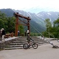
~天空の池~二児山~黒河山~ ![]()
2019/10/27 07:43 - 12:43 / Japan 大鹿村 二児山 黒河山 天空の池
![]()
| Total distance: | 18.51 | km | Trip time: | 5:00'00 | Average speed: | 8.5 | km/h | |
|---|---|---|---|---|---|---|---|---|
| Ascending altitude: | 764 | m | Elapsed time: | 3:06'56 | Total calories: | 1420 | kcal |
~天空の池~二児山~黒河山~
- Japan・大鹿村 二児山 黒河山 天空の池 2019/10/27 07:43 - 12:43
-
[Trip time] 5:00'00
[Total distance] 18.51km
[Average speed] 8.5km/h [Ascending altitude] 764m [Total calories] 1420kcal
[Tags] MTB, Recreation, Mountain


-
- camber comp
- View other bikes
山屋
(
Male /
Japan )
0
0

 maruyoyo
GPX export
Are you sure you want to export GPX data for this trip?
![]()
![]()