![]()
![]()
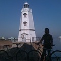
B200428浜寺公園420 ![]()
2020/04/28 09:37 - 11:48 / Japan 堺
![]()
| Total distance: | 33.7 | km | Trip time: | 2:11'07 | Average speed: | 19.2 | km/h | |
|---|---|---|---|---|---|---|---|---|
| Ascending altitude: | 146 | m | Elapsed time: | 1:45'14 | Total calories: | 649 | kcal |
B200428浜寺公園420
- Japan・堺 2020/04/28 09:37 - 11:48
-
[Trip time] 2:11'07
[Total distance] 33.7km
[Average speed] 19.2km/h [Ascending altitude] 146m [Total calories] 649kcal
[Tags] Road bike, Recreation
センサーレス
uesan
(
Male /
Japan )
0
0

 ゆーや
ゆーやGPX export
Are you sure you want to export GPX data for this trip?
![]()
![]()