![]()
![]()
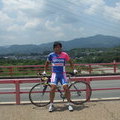
2021.1.23すたじおーね ![]()
2021/04/23 09:46 - 12:35 / Japan 貴志川町
![]()
| Total distance: | 50.44 | km | Trip time: | 2:48'39 | Average speed: | 23.7 | km/h | |
|---|---|---|---|---|---|---|---|---|
| Ascending altitude: | 406 | m | Elapsed time: | 2:03'04 | Total calories: | 816 | kcal |
2021.1.23すたじおーね
- Japan・貴志川町 2021/04/23 09:46 - 12:35
-
[Trip time] 2:48'39
[Total distance] 50.44km
[Average speed] 23.7km/h [Ascending altitude] 406m [Elapsed time] 2:03'04
[Total calories] 816kcal
[Tags] Road bike


-
- TREK5500
フレームTREK5500,主要構成パーツはデュラエース7700系、ホイールのみがWH-7850-TL 20年以上の前のシロモノですが気に入ってます。
View other bikes
たーやん
(
Male /
Japan )
0
0

 たーやん
たーやんGPX export
Are you sure you want to export GPX data for this trip?
![]()
![]()