![]()
![]()
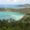
vening Litle Blue Trace ![]()
2014/09/07 17:16 - 18:47 / USA Blue Springs, Mo
![]()
| Total distance: | 27.37 | km | Trip time: | 1:31'10 | Average speed: | 18.5 | km/h | |
|---|---|---|---|---|---|---|---|---|
| Ascending altitude: | 253 | m | Elapsed time: | 1:26'01 | Total calories: | 175 | kcal |
| Split time | 00:01’08 | |
|---|---|---|
| Lap time | 00:01’08 | |
| Trip lap distance | 10.11 | km |
| Average | Maximum | |||
|---|---|---|---|---|
| Lap speed | 10.3 | km/h | 25 | km/h |
| Lap heart rate | 138.5 | bpm | 163 | bpm |
| Lap cadence | 50.1 | rpm | 87.5 | rpm |
vening Litle Blue Trace
- USA・Blue Springs, Mo 2014/09/07 17:16 - 18:47
-
[Trip time] 1:31'10
[Total distance] 27.37km
[Average speed] 18.5km/h [Ascending altitude] 253m [Total calories] 175kcal
[Tags] MTB, Recreation
Getting faster as we go


-
- Giant Talon 27.5 4
- View other bikes
BlueSprings2Wheel
(
Male /
USA )
0
0
![]()
![]()
![]()
-
 To Parkville and back home
 tgoodlt
USA・Kansas City, MO
2015/07/12
-
Home towards work - Rainstorm
tgoodlt
USA・Kansas City
2017/05/27
-
Blue River Parkway
BlueSprings2Wheel
USA・Independence, Mo
2014/06/22
-
To Parkville and back home
tgoodlt
USA・Kansas City
2015/07/25
-
Wet ride to/from Parkville
tgoodlt
USA・Riverside
2014/05/25
![]()
GPX export
Are you sure you want to export GPX data for this trip?
![]()
![]()