![]()
都民の森ポタ ![]()
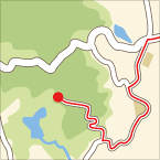
2014/10/25 08:49 - 12:01 / Japan 桧原
![]()
| Total distance: | 63.62 | km | Trip time: | 3:09'40 | Average speed: | 22.9 | km/h | |
|---|---|---|---|---|---|---|---|---|
| Ascending altitude: | 1960 | m | Elapsed time: | 2:43'04 | Total calories: | 1216 | kcal |
都民の森ポタ
- Japan・桧原 2014/10/25 08:49 - 12:01
-
[Trip time] 3:09'40
[Total distance] 63.62km
[Average speed] 22.9km/h [Ascending altitude] 1960m [Total calories] 1216kcal
[Tags] Road bike
ちょっと、二日酔いで不調。
今日も都民の森でくるみ味噌だんごを食べる。焼いてくれるおじいさんの笑顔が好きで、いつも買ってしまう。300円。


-
- スペシャライズドターマックSL4 pro
- View other bikes

KOM (Kodomo of Mountain)
(
Male /
Japan )
東京西部から神奈川、山梨、埼玉にかかるあたりを走ってます。キング・オブ・マウンテンに憧れるも、登りでは「こども」なみの脚力な中年ローディーです。

 motchee