![]()
![]()
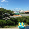
【自転車部】湘南平 ![]()
2015/02/01 09:08 - 12:45 / Japan 神奈川県茅ケ崎市
![]()
| Total distance: | 29.43 | km | Trip time: | 3:36'56 | Average speed: | 21.8 | km/h | |
|---|---|---|---|---|---|---|---|---|
| Ascending altitude: | 793 | m | Elapsed time: | 1:22'12 | Total calories: | 468 | kcal |
【自転車部】湘南平
- Japan・神奈川県茅ケ崎市 2015/02/01 09:08 - 12:45
-
[Trip time] 3:36'56
[Total distance] 29.43km
[Average speed] 21.8km/h [Ascending altitude] 793m [Total calories] 468kcal
[Tags] Road bike, Recreation
茅ヶ崎に移ってからの自転車部。記念すべき第1回。
茅ヶ崎のどこかにいる自転車屋です。
0
0

 TAKI
TAKIGPX export
Are you sure you want to export GPX data for this trip?
![]()
![]()