![]()
![]()
水越峠 ![]()
2015/03/08 05:43 - 09:39 / Japan 大阪
![]()
| Total distance: | 81.23 | km | Trip time: | 336:55'58 | Average speed: | 22 | km/h | |
|---|---|---|---|---|---|---|---|---|
| Ascending altitude: | 1508 | m | Elapsed time: | 3:33'26 | Total calories: | 1160 | kcal |
| Split time | 00:01’08 | |
|---|---|---|
| Lap time | 00:01’08 | |
| Trip lap distance | 10.11 | km |
| Average | Maximum | |||
|---|---|---|---|---|
| Lap speed | 10.3 | km/h | 25 | km/h |
| Lap heart rate | 138.5 | bpm | 163 | bpm |
| Lap cadence | 50.1 | rpm | 87.5 | rpm |
水越峠
- Japan・大阪 2015/03/08 05:43 - 09:39
-
[Trip time] 336:55'58
[Total distance] 81.23km
[Average speed] 22km/h [Ascending altitude] 1508m [Total calories] 1160kcal
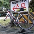
[Tags] Road bike, Training
S・R・S
(
Japan )
0
0

 タケマル
タケマルGPX export
Are you sure you want to export GPX data for this trip?
![]()
![]()