![]()
![]()
lognor ![]()
2015/04/07 10:58 - 14:25 / UK peak district
![]()
| Total distance: | 48.76 | km | Trip time: | 3:26'17 | Average speed: | 18.2 | km/h | |
|---|---|---|---|---|---|---|---|---|
| Ascending altitude: | 747 | m | Elapsed time: | 3:05'42 | Total calories: | 724 | kcal |
lognor
- UK・peak district 2015/04/07 10:58 - 14:25
-
[Trip time] 3:26'17
[Total distance] 48.76km
[Average speed] 18.2km/h [Ascending altitude] 747m [Total calories] 724kcal
[Tags] Road bike


-
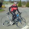
- Giant defy. Road
- View other bikes
John friend
(
UK )
0
0

 bigdave
GPX export
Are you sure you want to export GPX data for this trip?
![]()
![]()