![]()
![]()
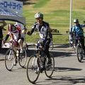
夜越山 ![]()
2014/10/01 12:32 - 2014/10/04 12:51 / Japan 平内町
![]()
| Total distance: | 116.63 | km | Trip time: | 72:18'58 | Average speed: | 23.1 | km/h | |
|---|---|---|---|---|---|---|---|---|
| Ascending altitude: | 1407 | m | Elapsed time: | 5:08'05 | Total calories: | 1531 | kcal |
| Split time | 00:01’08 | |
|---|---|---|
| Lap time | 00:01’08 | |
| Trip lap distance | 10.11 | km |
| Average | Maximum | |||
|---|---|---|---|---|
| Lap speed | 10.3 | km/h | 25 | km/h |
| Lap heart rate | 138.5 | bpm | 163 | bpm |
| Lap cadence | 50.1 | rpm | 87.5 | rpm |
夜越山
- Japan・平内町 2014/10/01 12:32 - 2014/10/04 12:51
-
[Trip time] 72:18'58
[Total distance] 116.63km
[Average speed] 23.1km/h [Ascending altitude] 1407m [Total calories] 1531kcal
[Tags]


-
- TREK
- View other bikes
ken16
(
Male /
Japan )
よろしくです
0
0

 tsuna_xvh
GPX export
Are you sure you want to export GPX data for this trip?
![]()
![]()