![]()
![]()
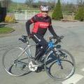
Acton Burnell loop. ![]()
2015/04/21 17:25 - 19:20 / UK Shrewsbury
![]()
| Total distance: | 41.92 | km | Trip time: | 1:54'17 | Average speed: | 23.1 | km/h | |
|---|---|---|---|---|---|---|---|---|
| Ascending altitude: | 344 | m | Elapsed time: | 1:48'33 | Total calories: | 698 | kcal |
Acton Burnell loop.
- UK・Shrewsbury 2015/04/21 17:25 - 19:20
-
[Trip time] 1:54'17
[Total distance] 41.92km
[Average speed] 23.1km/h [Ascending altitude] 344m [Total calories] 698kcal
[Tags] Road bike


-
- Giant defy. Road
- View other bikes
John friend
(
UK )
0
0

 Brian Morris
GPX export
Are you sure you want to export GPX data for this trip?
![]()
![]()