![]()
吉備高原自転車道 ![]()
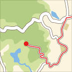
2015/05/28 10:44 - 13:39 / Japan 吉備高原自転車道
![]()
| Total distance: | 48.37 | km | Trip time: | 2:55'20 | Average speed: | 17.2 | km/h | |
|---|---|---|---|---|---|---|---|---|
| Ascending altitude: | 266 | m | Descending altitude: | 273 | m | Total calories: | 637 | kcal |
吉備高原自転車道
- Japan・吉備高原自転車道 2015/05/28 10:44 - 13:39
-
[Trip time] 2:55'20
[Total distance] 48.37km
[Average speed] 17.2km/h [Ascending altitude] 266m [Descending altitude] 273m
[Total calories] 637kcal
[Tags] Road bike, Long touring, City
吉備高原自転車道を走ってきました。
吉備中央町まで行く予定でしたが、時間切れのため黒谷ダムで折り返し。


-
- PINARELLO ANGLIRU
- View other bikes

アベサイクル
(
Japan )
創業は1947年。祖父から始まり3代目です。家族3人で、地域の頼れる自転車屋を目指して日々奮闘してます。 シティーサイクル・一般車はもちろん、電動アシスト車・クロスバイク・ロードバイク・マウンテン・折りたたみ車・小径車など、何でもOK! 家族全員、持ち前の明るさで頑張っています!ぜひ遊びに来てください!


 Team-Natural やまうち