![]()
![]()
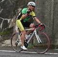
室生寺~曽爾村~香落渓~青蓮寺ダム ![]()
2015/07/11 05:33 - 09:17 / Japan 三重県名張市
![]()
| Total distance: | 57.45 | km | Trip time: | 3:44'19 | Average speed: | 18.4 | km/h | |
|---|---|---|---|---|---|---|---|---|
| Ascending altitude: | 1487 | m | Elapsed time: | 3:12'03 | Total calories: | 1612 | kcal |
室生寺~曽爾村~香落渓~青蓮寺ダム
- Japan・三重県名張市 2015/07/11 05:33 - 09:17
-
[Trip time] 3:44'19
[Total distance] 57.45km
[Average speed] 18.4km/h [Ascending altitude] 1487m [Total calories] 1612kcal
[Tags] Road bike


-
- Basso Monza
- View other bikes
36
(
Male /
Japan )
0
0

 masakinakaya

GPX export
Are you sure you want to export GPX data for this trip?
![]()
![]()