![]()
![]()
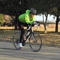
立トラ 昭和記念公園 ![]()
2015/07/25 09:09 - 10:54 / Japan 昭和記念公園
![]()
| Total distance: | 36.01 | km | Trip time: | 1:45'43 | Average speed: | 25.5 | km/h | |
|---|---|---|---|---|---|---|---|---|
| Ascending altitude: | 549 | m | Elapsed time: | 1:23'08 | Total calories: | 399 | kcal |
立トラ 昭和記念公園
- Japan・昭和記念公園 2015/07/25 09:09 - 10:54
-
[Trip time] 1:45'43
[Total distance] 36.01km
[Average speed] 25.5km/h [Ascending altitude] 549m [Total calories] 399kcal
[Tags] Road bike, Training


-
- PROPEL
- View other bikes
サイクロン
(
Male /
Japan )
0
0

 Gucchini
GPX export
Are you sure you want to export GPX data for this trip?
![]()
![]()