![]()
![]()
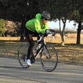
尾根幹 ![]()
2015/09/27 07:35 - 11:57 / Japan 尾根幹
![]()
| Total distance: | 56.69 | km | Trip time: | 4:21'19 | Average speed: | 23.1 | km/h | |
|---|---|---|---|---|---|---|---|---|
| Ascending altitude: | 1324 | m | Elapsed time: | 2:29'53 | Total calories: | 808 | kcal |
尾根幹
- Japan・尾根幹 2015/09/27 07:35 - 11:57
-
[Trip time] 4:21'19
[Total distance] 56.69km
[Average speed] 23.1km/h [Ascending altitude] 1324m [Total calories] 808kcal
[Tags] Road bike, Training


-
- PROPEL
- View other bikes
サイクロン
(
Male /
Japan )
0
0

 Falcon
GPX export
Are you sure you want to export GPX data for this trip?
![]()
![]()