![]()
![]()
201111阿蘇サイクリング2日目その2 ![]()
2011/11/24 14:34 - 18:11 / Japan 阿蘇
![]()
| Total distance: | 38.08 | km | Trip time: | 3:36'52 | Average speed: | 15.3 | km/h | |
|---|---|---|---|---|---|---|---|---|
| Ascending altitude: | 255 | m | Descending altitude: | 418 | m | Total calories: | 477 | kcal |


201111阿蘇サイクリング2日目その2
- Japan・阿蘇 2011/11/24 14:34 - 18:11
-
[Trip time] 3:36'52
[Total distance] 38.08km
[Average speed] 15.3km/h [Ascending altitude] 255m [Descending altitude] 418m
[Total calories] 477kcal
[Tags] Mini Velo, Recreation, Mountain
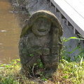
高森湧水トンネル公園を後にし、高森周辺の食事場所を求めて彷徨い(意外に満杯の所が多かった)、最終的に田楽の里に落ち着いた。いいところでした。
その後は阿蘇西端の渓谷までR325旧道を走り、途中の白川水源を経由しつつ、阿蘇の秋を堪能。最終的に輪行組と別れて、立野から今日の泊地内牧温泉へと自走した。途中で日が暮れたため、自動撮影は停止した。


-
- Bikefriday PocketRocket Pro
旅用(そしてトラベルケース宅配用)の折りたたみ自転車です。移動の負担を減らすために、重量と走りと、2重の意味での軽さを目指しました。コンポはSRAM RED。
View other bikes
wintermute
(
Male )
横浜のおっさん。自転車、星見、時々ブンガク。 Blogページは http://southofheaven.info/ です。
0
0

 いとじゅん
いとじゅんGPX export
Are you sure you want to export GPX data for this trip?
![]()
![]()