![]()
![]()
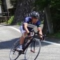
奥武蔵グリーンライン(正丸~巾着田) ![]()
2015/10/25 09:26 - 17:06 / Japan 飯能
![]()
| Total distance: | 105.71 | km | Trip time: | 7:40'34 | Average speed: | 19.2 | km/h | |
|---|---|---|---|---|---|---|---|---|
| Ascending altitude: | 2467 | m | Elapsed time: | 5:16'21 | Total calories: | 1402 | kcal |
| Split time | 00:01’08 | |
|---|---|---|
| Lap time | 00:01’08 | |
| Trip lap distance | 10.11 | km |
| Average | Maximum | |||
|---|---|---|---|---|
| Lap speed | 10.3 | km/h | 25 | km/h |
| Lap heart rate | 138.5 | bpm | 163 | bpm |
| Lap cadence | 50.1 | rpm | 87.5 | rpm |
奥武蔵グリーンライン(正丸~巾着田)
- Japan・飯能 2015/10/25 09:26 - 17:06
-
[Trip time] 7:40'34
[Total distance] 105.71km
[Average speed] 19.2km/h [Ascending altitude] 2467m [Total calories] 1402kcal
[Tags] Bicycle, Road bike
強風、視程もよくなかった。


-
- Émonda ALR Di2カスタム
よく走るアルミバイクです。 値段もお買い得
View other bikes
sugit
(
Male /
Japan )
回した分だけ強くなる!
0
0

 レジ
レジGPX export
Are you sure you want to export GPX data for this trip?
![]()
![]()