![]()
![]()
トレーニングコース ![]()
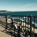
2015/12/06 11:01 - 14:15 / Japan うぐいすライン〜長南町
![]()
| Total distance: | 52.44 | km | Trip time: | 3:14'48 | Average speed: | 26.2 | km/h | |
|---|---|---|---|---|---|---|---|---|
| Ascending altitude: | 705 | m | Elapsed time: | 2:02'47 | Total calories: | 1096 | kcal |
トレーニングコース
- Japan・うぐいすライン〜長南町 2015/12/06 11:01 - 14:15
-
[Trip time] 3:14'48
[Total distance] 52.44km
[Average speed] 26.2km/h [Ascending altitude] 705m [Elapsed time] 2:02'47
[Total calories] 1096kcal
[Tags] Road bike


-
- caad10
ampioからcaad10へ
View other bikes
さんたまりあ
(
Male /
Japan )
毎週末、房総半島をマイペースでポタってます!
0
0

 Yシャツ
YシャツGPX export
Are you sure you want to export GPX data for this trip?
![]()
![]()