![]()
![]()
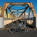
我孫子→関宿城公園→南流山→我孫子 ![]()
2016/02/11 09:30 - 16:02 / Japan 千葉県我孫子市、茨城県岩井市、他、
![]()
| Total distance: | 87.39 | km | Trip time: | 6:31'25 | Average speed: | 23.6 | km/h | |
|---|---|---|---|---|---|---|---|---|
| Ascending altitude: | 955 | m | Elapsed time: | 3:52'58 | Total calories: | 1486 | kcal |
我孫子→関宿城公園→南流山→我孫子
- Japan・千葉県我孫子市、茨城県岩井市、他、 2016/02/11 09:30 - 16:02
-
[Trip time] 6:31'25
[Total distance] 87.39km
[Average speed] 23.6km/h [Ascending altitude] 955m [Total calories] 1486kcal
[Tags] Road bike, Training, Riverside
南流山のスワッチさんでピナレロの試乗の前に利根川CR→江戸川CRと回った。1ヶ月ぶりのライド。関宿滑空場あたりで向かい風が吹きだし、疲れもあって終盤はヘロヘロ。南流山から運河を通って戻る計画だったがおとなしく6号で帰宅。ピナレロGANの赤に惚れた。
okiba
(
Not set )
~2015年3月 神奈川県横浜市都筑区に居住・主に鶴見川CRを走行、2015年4月~2017年3月 千葉県我孫子市に居住・主に手賀沼CRと利根川CRを走行、2017年4月~ 新潟県新潟市中央区に居住中・主に国道402号を走行。
0
0

 arachi
GPX export
Are you sure you want to export GPX data for this trip?
![]()
![]()