![]()
![]()
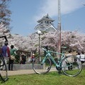
御幸橋⇔嵐山 ![]()
2016/05/01 09:08 - 14:37 / Japan 嵐山
![]()
| Total distance: | 42.11 | km | Trip time: | 5:28'04 | Average speed: | 16.9 | km/h | |
|---|---|---|---|---|---|---|---|---|
| Ascending altitude: | 267 | m | Elapsed time: | 2:38'36 | Total calories: | 471 | kcal |
御幸橋⇔嵐山
- Japan・嵐山 2016/05/01 09:08 - 14:37
-
[Trip time] 5:28'04
[Total distance] 42.11km
[Average speed] 16.9km/h [Ascending altitude] 267m [Total calories] 471kcal
[Tags]
同僚とその嫁と3人でポタリング
一人はギヤ車が初めてでシフト操作教えながら極低速で走行
何とか往復できた。
いつもより返って疲れた~


-
- ビアンキインテンソ105
自転車売り場で一目ぼれ!
View other bikes
アラフィフライダー
(
Male /
Japan )
おなかの出っ張りが気になりだして自転車始めた~~ クロスで物足らず中年ローディになってしまった!
0
0

 ドギー
ドギーGPX export
Are you sure you want to export GPX data for this trip?
![]()
![]()