![]()
![]()
阿賀野川河口→横雲橋→新潟みなとトンネル ![]()
2017/05/07 10:41 - 14:39 / Japan 新潟市中央区のあたり
![]()
| Total distance: | 60.25 | km | Trip time: | 3:57'24 | Average speed: | 23.1 | km/h | |
|---|---|---|---|---|---|---|---|---|
| Ascending altitude: | 325 | m | Elapsed time: | 2:58'17 | Total calories: | 1002 | kcal |
阿賀野川河口→横雲橋→新潟みなとトンネル
- Japan・新潟市中央区のあたり 2017/05/07 10:41 - 14:39
-
[Trip time] 3:57'24
[Total distance] 60.25km
[Average speed] 23.1km/h [Ascending altitude] 325m [Total calories] 1002kcal
[Tags] Road bike, Training, Riverside
予報では10mの風。ダメなら戻るつもりで結局60キロ走行。泰平橋→阿賀野川河口→横雲橋→泰平橋→新潟みなとトンネル→昭和大橋とまわって帰宅。萬代橋に向かったつもりだったんだけどな。まだ地理はさっぱり。阿賀野川沿いの一般県道安田新潟自転車道線は、車は走るけど少なくて快適だ。舗装がもう少し更新されるといいな。


-
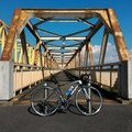
- TREK EMONDA SL5
鮮やかなライムグリーンに一目惚れ。でも高価。デファイだってあるし、必要ないじゃん。そう、その通り。でも購入(^^)。バーテープをブルーにしたのはエディーローソンレプリカを意識してるんだけど気付く人はきっといない。 2016年11月・ホイールをカンパ ゾンダに交換。思ったより違いが判らない(^^;)。
View other bikes
okiba
(
Not set )
~2015年3月 神奈川県横浜市都筑区に居住・主に鶴見川CRを走行、2015年4月~2017年3月 千葉県我孫子市に居住・主に手賀沼CRと利根川CRを走行、2017年4月~ 新潟県新潟市中央区に居住中・主に国道402号を走行。
0
0

 af-ro
af-roGPX export
Are you sure you want to export GPX data for this trip?
![]()
![]()