![]()
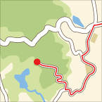
長与ー伊木力(往復) ![]()
2019/03/31 12:10 - 13:52 / Japan 長崎県西彼杵郡長与町
![]()
| Total distance: | 23.42 | km | Trip time: | 1:41'46 | Average speed: | 15.5 | km/h | |
|---|---|---|---|---|---|---|---|---|
| Ascending altitude: | 245 | m | Descending altitude: | 264 | m | Total calories: | 328 | kcal |
長与ー伊木力(往復)
- Japan・長崎県西彼杵郡長与町 2019/03/31 12:10 - 13:52
-
[Trip time] 1:41'46
[Total distance] 23.42km
[Average speed] 15.5km/h [Ascending altitude] 245m [Descending altitude] 264m
[Total calories] 328kcal
[Tags] Road bike, Recreation, Spring
サクラ満開の中のライド
道が一部凸凹しているだろうと32Cの方を車に積み、長与町の公園駐車場まで出掛けた
道は多少狭い処もあるが高低差があまりないのでライドしやすかった
現在道路改修が進んでおり、次回のライドに期待が持てる


-
- FELT VR60(510mm)オレンジ
700-28Cから700-32Cにタイヤ変更してます
View other bikes

ishugenhohaku
(
Male /
Japan )


 チャねひろ
チャねひろ