![]()
![]()
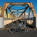
手賀沼→利根川→手賀沼 ![]()
2015/10/21 09:23 - 14:57 / Japan 千葉県
![]()
| Total distance: | 76.36 | km | Trip time: | 5:34'09 | Average speed: | 23.5 | km/h | |
|---|---|---|---|---|---|---|---|---|
| Ascending altitude: | 342 | m | Elapsed time: | 4:20'53 | Total calories: | 1326 | kcal |
手賀沼→利根川→手賀沼
- Japan・千葉県 2015/10/21 09:23 - 14:57
-
[Trip time] 5:34'09
[Total distance] 76.36km
[Average speed] 23.5km/h [Ascending altitude] 342m [Total calories] 1326kcal
[Tags] Road bike, Riverside, Autumn
もっと遠出のつもりだったけど、強風のため常総大橋で引き返しました。帰宅後頭痛と寒気。引き返して正解でした。
サイコンともスマホともペアリング出来てるのにケイデンスセンサが動きません…。
okiba
(
Not set )
~2015年3月 神奈川県横浜市都筑区に居住・主に鶴見川CRを走行、2015年4月~2017年3月 千葉県我孫子市に居住・主に手賀沼CRと利根川CRを走行、2017年4月~ 新潟県新潟市中央区に居住中・主に国道402号を走行。
0
0

 だびる
だびるGPX export
Are you sure you want to export GPX data for this trip?
![]()
![]()